Also see related videos:
 Swannanoa NC Update April 2025 – Hurricane Helene Recovery Documentation with drone footage
Hurricane Helene Update – Bat Cave, Chimney Rock, Hickory Nut Gorge North Carolina – April 2025
Hurricane Helene Update – NC Arboretum, Asheville North Carolina – March 2025
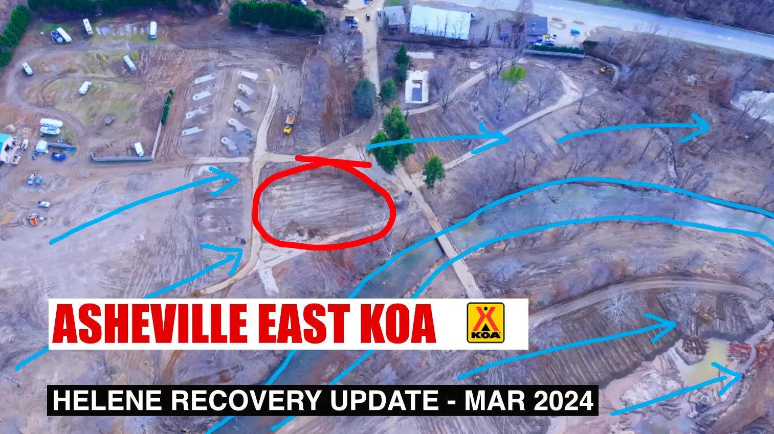
Hurricane Helene Update – Asheville East KOA, Swannanoa NC – March 2025
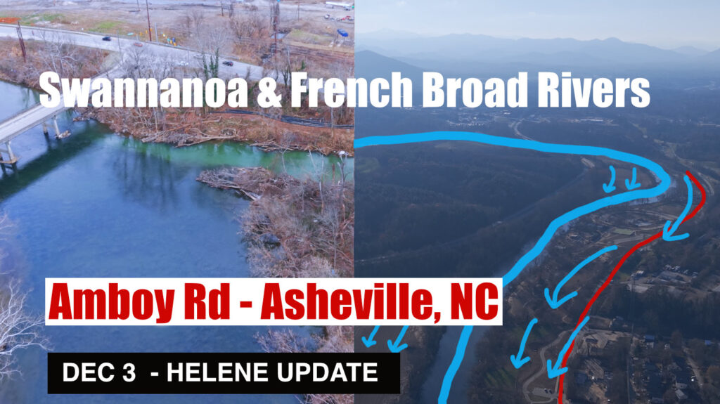
Helene Impact Update Dec 3 – Asheville: Swannanoa & French Broad River converge at Amboy Road
Helene Impact Update Dec 2 & 3 – Biltmore Village, Asheville, North Carolina, Swannanoa River
Helene Impact Update Nov 21 – North Fork Reservoir Auxiliary Spillway -Black Mountain, NC
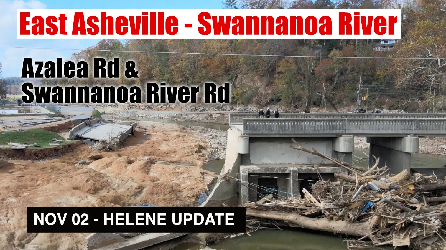
Helene Impact Update Nov 2 – East Asheville, Swannanoa River Rd and Azalea Rd
Helene Impact Update Nov 2 – Asheville, Riceville Rd, Bull Creek, Forest Damage & Swannanoa River
Helene Impact Update Oct 29 – Debris Flow at Black Mountain Home & Shepard of the Hills Retreat
Helene Impact Update Oct 25 – Swannanoa Debris Flow, Grovemont Community
Helene Impact Update Oct 16 – Swannanoa Watershed: Part 1 – Montreat & Flat Creek to Black Mountain
Helene Impact Update Oct 18-22 – Swannanoa Watershed: Part 2 – North Fork Swannanoa River, Reservoir
Swannanoa NC – Hwy 70 – 2024-10-12 – Recovery from Hurricane Helene
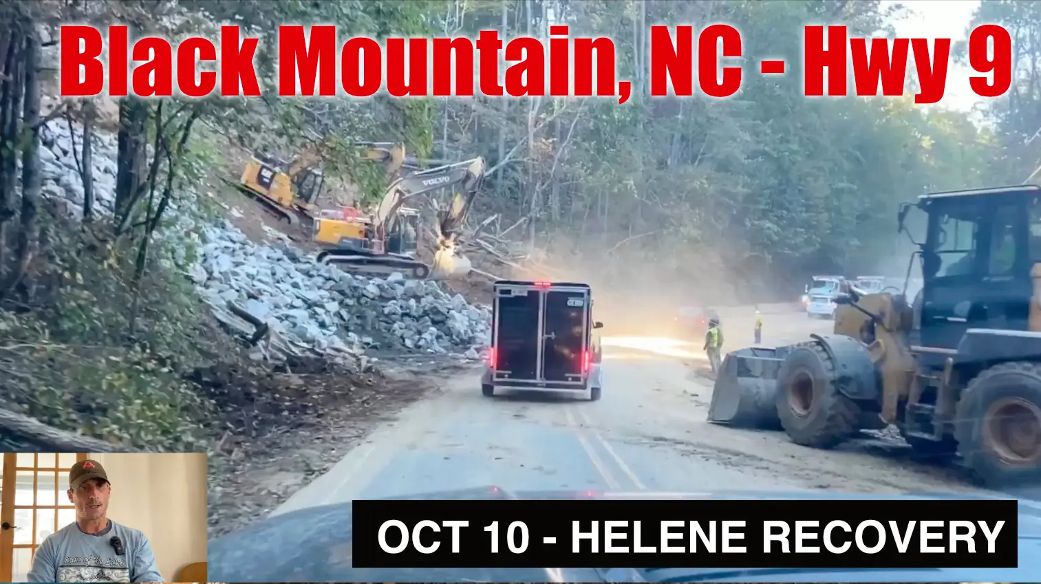
Helene Impact – Oct 20 Broad River & Flat Creak aerial footage – Hwy 9 Black Mountain NC